Hurricane
Hurricane is a rapidly growing town located about 19 miles northeast of St. George. It is on Highway 9 which connects with Interstate 15. It was originally settled at the turn of the century when a canal was eventually built to support a town here in Hurricane. Now the area has many orchards and turf grass farms. It also welcomes millions of people a year who travel through the town to visit Zion Canyon in Zion National Park.
Children attend Hurricane Elementary School, Hurricane Middle School, and Hurricane High School. The town hosts many recreational leagues covering many sports for all ages, and Hurricane is also home to Sky Mountain Golf Course - a scenic 18 hole and par 72 course.
http://en.wikipedia.org/wiki/Hurricane%2C_Utah
Ivins
At the foot of dramatic 1,500 foot red cliffs, Ivins is truly a beautiful place to live. It is also home Tuacahn Center for the Arts which brings Broadway to the desert and Red Mountain Spa which offers luxurious pampering and rejuvenating recreational activities. The town was not settled until the early 1920s after a canal was finally built in the area during World War I. Ivins is a few miles northeast of St. George and is near Snow Canyon State Park.
School students in Ivins attend Red Mountain Elementary School, Lava Ridge Intermediate School, Snow Canyon Middle School, and Snow Canyon High School. Ivins has one park with many amenities, two mini-parks that offer a few amenities, and two parks devoted to the natural landscape.
http://en.wikipedia.org/wiki/Ivins%2C_Utah
La Verkin
La Verkin is just north of Hurricane on SR-9 on the Virgin River. The La Verkin Fruit and Nursery Company which incorporated in the late 1880s, and helped bring people and money to the town. Today it is a growing town since nearby Hurricane is rapidly growing.
Children in La Verkin attend La Verkin Elementary, Hurricane Middle School, and Hurricane High School.
http://en.wikipedia.org/wiki/La_Verkin%2C_Utah
Leeds
Located 17 miles northeast of St. George on Interstate 15 is Leeds. It was established in 1867, but really began to grow a few years later when silver was discovered in nearby Silver Reef. Today the town enjoys a peaceful existence near the Quail Creek State Park and other points of interest like Silver Reef ghost town.
Children here attend La Verkin Elementary, Hurricane Middle School, and Hurricane High School.
http://en.wikipedia.org/wiki/Leeds%2C_Utah
New Harmony
About 40 miles northeast of St. George is the small bedroom community of New Harmony. This area is known for its orchards that produce delicious fruit. Of note, it was the first settlement and county seat of Washington County when it was established in 1852.
http://en.wikipedia.org/wiki/New_Harmony%2C_Utah
Pine Valley
Pine Valley, about 35 miles north of St. George, is a picturesque community with uncharacteristic green pine trees and meadows. This is a favorite place for Southern Utahns to visit since it is so green and unlike the desert landscape of the rest of the region.
Students from Pine Valley attend Enterprise Elementary School and Enterprise High School.
http://en.wikipedia.org/wiki/Pine_Valley%2C_Utah
Pintura (formerly named Bellevue)
http://www.lofthouse.com/USA/Utah/washington/pintura.html
Rockville
Rockville is just west of Springdale and the mouth to Zion Canyon in Zion National Park on SR-9. It was originally settled in the 1860s by early Mormon settlers who were trying to set up cotton growing areas here. Now, it is a bedroom community that welcomes millions of annual visitors who come to see Zion National Park.
Children in Rockville attend Springdale Elementary, Hurricane Middle School, and Hurricane High School.
http://en.wikipedia.org/wiki/Rockville%2C_Utah
Santa Clara
Santa Clara began when Jacob Hamblin and other Mormon missionaries built a cabin in the 1850s on the Santa Clara River to work with the Paiute Indians and travelers going to California during. Now, Santa Clara is a prosperous community whose borders with St. George are now almost indistinguishable. It is also near Snow Canyon State Park.
Kids in Santa Clara attend Santa Clara Elementary School, Lava Ridge Intermediate School, Snow Canyon Middle School, and Snow Canyon High School. Santa Clara is also home to the Archie H. Gubler and A, B & Pony League ball fields and the Santa Clara Arboretum that has a beautiful cactus garden.
http://en.wikipedia.org/wiki/Santa_Clara%2C_Utah
Silver Reef
Silver Reef is about 18 miles northeast of St. George and has an interesting history. It was a silver mining town after silver was discovered here in the 1870. The silver mining industry brought many businesses here, and historic building still stand. People from all over the area come here to visit this ghost town.
Springdale
http://en.wikipedia.org/wiki/Springdale%2C_UtahSt. George
http://en.wikipedia.org/wiki/St._George%2C_Utah
Toquerville
Toquerville is six miles northwest of Hurricane, and is a pleasant little town.
Children attend La Verkin Elementary School, Hurricane Middle School, and Hurricane High School.
http://en.wikipedia.org/wiki/Toquerville%2C_Utah
Veyo
Veyo is a small community about 16 miles north of St. George on SR-18. The community was established in 1914 after a canal was built to bring water to the town. Just north of Veyo is Brookside. The community has several businesses despite its small size and out-of-the-way location.
Students from Veyo can either attend Diamond Valley Elementary School, Desert Hills Intermediate School, Dixie Middle School, and Dixie High School or Enterprise Elementary School and Enterprise High School. Veyo has a park that families can enjoy together.
http://en.wikipedia.org/wiki/Veyo%2C_Utah
Virgin
Virgin is a few miles east of Hurricane on SR-9. It welcomes millions of people each who travel along SR-9 on their way to Zion Canyon in Zion National Park. Access to Kolob Canyon in the national park from the south is only through Virgin. The town was settled in the 1850s as a farming community. Oil was even drilled here for a few decades.
Student from Virgin attend La Verkin Elementary School, Hurricane Middle School, and Hurricane High School.
http://en.wikipedia.org/wiki/Virgin%2C_Utah
Washington City
Just northeast of St. George is Washington City. It was originally founded as part of a cotton growing mission in Southern Utah by early Mormon pioneers in the 1850s just before the Civil War. Since then Washington City has grown like St. George and other Washington County cities. Currently, the city is enjoying an influx of retirees who find the mild winters here attractive.
Washington City children attend Washington Elementary School, Fossil Ridge Intermediate School, Pine View Middle School, and Pine View High School. Washington City also runs Green Spring Golf Course, two parks, ballparks, and a swimming pool.
http://en.wikipedia.org/wiki/Washington%2C_Utah
Winchester Hills, Diamond Valley, & Dammeron Valley
These three housing developments north of St. George along SR-18 flourished over the last 15 years. People who live in these developments want to live both near the natural scenery of Southern Utah while enjoying living close to the conveniences of St. George. Many of the residents own animals like horses and chickens. These developments are all close to the northeast entrance of Snow Canyon State Park, and a new community is developing surrouding The Ledges Golf Course just south of Winchester Hills.
Students from these communities attend Diamond Valley Elementary School, Desert Hills Intermediate, Dixie Middle School, and Dixie High School. Each development has a park for residents to enjoy with their families.
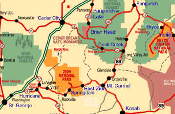
click on the following maps to enlarge slightly


 http://www.washco.state.ut.us/